Saturday 20 June 2009

Downtown Vancouver (Pt 1)


I've said a lot about what's outside Vancouver itself, but not a lot of what's in Vancouver to see and do.
First off, Vancouver's HUGE. Like, really huge. When you consider Richmond, Burnaby, North Van, Granville and Metrotown, the more outlying areas which bring a lot to Vancouver, you're looking at a city the size of Manchester or similar.
Downtown Vancouver, though, is where the majority of the things to see and do are (duh). It's got the main shops, restaurants, bars, clubs, cinemas, coffee shops... everything. It's also got the harbour, waterfront and the most amazing view of mountains and wilderness that you'll probably ever see from a major city. Downtown Vancouver's made up of a few areas - Gastown, the main tourist part; Granville and Granville Island, where there's a really good public market; the West End with Davie Village; Stanley Park, an amazingly scenic wooded park area; and Chinatown (which is pretty explanatory).


This is Gastown. It looks almost American! The steamclock is a tourist attraction in itself, I've got a video of it doing its thing. It's like a normal clock but steam instead of chimes (it's more fun than it sounds...).
Posted by Picasa

Downtown Vancouver (Pt 2)


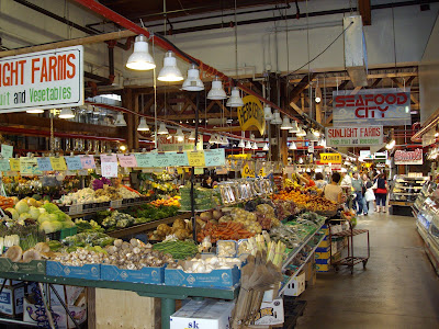
Granville Island and the market is amazing. In the same corridor you can get live crabs and watch toffee being made, or watch First Nations/aboriginie art being produced. It's not even expensive, either. The island itself is full of shops and restaurants with gorgeous views of the city. The bridge in the third picture is Granville Street Bridge, one of the main roads into Downtown Vancouver.
Posted by Picasa

Downtown Vancouver (Pt 3)


The Harbour! My favourite bit. This is really active with lots of cruisers, cargo boats and floatplanes going in and out all the time. And there's Stanley Park. The big ringer for the Golden Gate Bridge is the Lion's Gate Bridge (I'll have photos of it's sibling in a fortnight). Bears and cougars live in the woods here and I've been warned off trying to find them. Disappointed :(
Posted by Picasa

Downtown Vancouver (Pt 4)


Chinatown. The first couple of blocks are spectacular - the gate is gorgeous, the buildings have a lot of character and there are hidden little gems like the Chinese garden with the koi carp (you'd think you'd disappeared into Asia until you hear the SkyTrain in the distance). The rest of it? Don't walk any further in if you value your wallet. But the rest is nice!
Posted by Picasa

Victoria, 11th June. (Pt 1)


When you talk about Vancouver, it can get a little confusing. There's the big city, called Vancouver obviously), and all the little edge cities like Burnaby, Richmond, Surrey, New Westminster etc., which most non-Canadians consider to be 'all there is'. But actually, there's a whole island which belongs to Vancouver too - unsurprisingly called Vancouver Island. It's actually got the provincial capital of British Columbia on it - Victoria, situated to the South of the island on the coast. It's quite a long way to go to get to it - the ferry itself is like 2 hours long (longer than the English Channel ferry but half as boring - and half as expensive) and the drive either end is about the same amount of time. But when you get there, it's more than worth it.


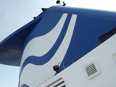
So our day started in the little coastal port of Tsawassen with a ferry - a BC Ferry, which smelt like new paint and disinfectant. I don't know why, but here's a funnel shot...


I actually fell asleep just after we left the dock and was woken up. "You might want to get photos of what's outside..."


The islands were beautiful. They've all got communities on them who basically live by the ferry service from mainland Vancouver.


Annnnnd 2 and a half hours later we're here! In very hot, sunny Victoria. The Empress is a 5* hotel in the capital - and the only hotel the Queen uses when she visits Vancouver. The guy in the bottom left of the image, on the bike, offers lifts around the city for like, $8, like a pedal rickshaw. Legs of steel, man.

Posted by Picasa

Victoria, 11th June. (Pt 2)

The harbour is really busy, and floatplanes take off every 20 minutes or so, which is a sight. We even saw a seal! (Video to follow, I got all excited since no one else saw it)


This is the State Legislature, where the Premier of the Province governs from. (Or so Alex tells me). And I never went in it :( Oops...


Here's a Government of Canada building and a really weird tree - in Canada, there's lots of both.


This is the main street running through Victoria, with lots of pretty expensive* shops and restaurants. It's also got lots of panhandlers, like the one in the bottom left. She was cool though, she juggled and everything...
Posted by Picasa

Victoria, 11th June. (Pt 3)


Time to head back, and there's some lovely other little islands, along with 'Murickans on the deck talking on cellphones and insisting their scenery is better (I'm not joking).


I can't express how much I'd actually kill for one of these houses as a summer home when I'm older...


Finally, this is an undersea mountain according to Lonely Planet, which pokes above the water. Apparently it also looks like a pregnant woman laying down on her back!

Tuesday 16 June 2009

Whistler, 9th June. (Pt. 4)

On the drive back, there were some awesome views. Still mountain lakes, rapid rivers, alsorts. But there's one view I want to share and I'll let the photo do the talking. By the way - the white crinkly bits which you might think are clouds? They're snow-covered mountains. Amazing.

Posted by Picasa

Whistler, 9th June. (Pt. 3)


Another view from the top.


This guy is called Inukshuck. It's a stone figure that the First Nations Peoples (aboriginies) used in time gone by to warn/inform/alert other groups of nomads to their own presence. People make them on the beaches in Vancouver too - those stones aren't cemented, by the way. They're balanced.


On the other side, over that huuuuuuge valley, is another peak, Blackcomb. There's a cable car which I *could* have gotten between them, but that valley's like, 6100ft deep and I didn't fancy that gamble at the time. D'oh!


This is the view into the valley I just came from. You can't see the village of Whistler because it's behind the main brow of the mountain. The base of the mountain is something like 200ft ASL, I'm 6300ft ASL. That's a lot of feet.

Posted by Picasa

Whistler, 9th June. (Pt. 2)


This is about 2000-2500 feet up, looking to the North-East I think. The woods are basically untouched and are incredibly, awesomely beautiful.


Yes, that is snow at the top of those mountains. The air temperature up here is about 0*c; the air temperature down at the cable car station is about 20*c. I was dressed for 20*c. I was cold...


You remember that mountain from before? Oh, you do? There it is, first on the left. And I'm only about 2/3rds the way up Whistler.


So we're at the summit now... and it looks like winter. It actually started snowing, but lightly, just after I stopped taking photos. In June. How amazing is that?
Posted by Picasa

Whistler, 9th June. (Pt. 1)

So on the 9th of June we went to Whistler, which is a ski resort about 2 hours North of Vancouver. It's where Canada are hosting the 2010 Winter Olympics (or they're supposed to host, judging by the amount of buildings they haven't yet built...). It's touristy but it's very nice and shiny and new and still looks all traditional despite the newness.


The carpark doesn't look so enthralling...


...But then the main street's all new! And traditional! (Have I made it Clear how it looks new and traditional?)


The view down the main street. I really don't think anywhere in Britain beats this.


This still isn't the tallest mountain in the area. Actually, the pictures later kinda put it in perspective...
Posted by Picasa